Gulf of Papua - uniform erodibility coefficient
Rhiannon Garrett
Software Used:
- Badlands 1.0
Model Setup:
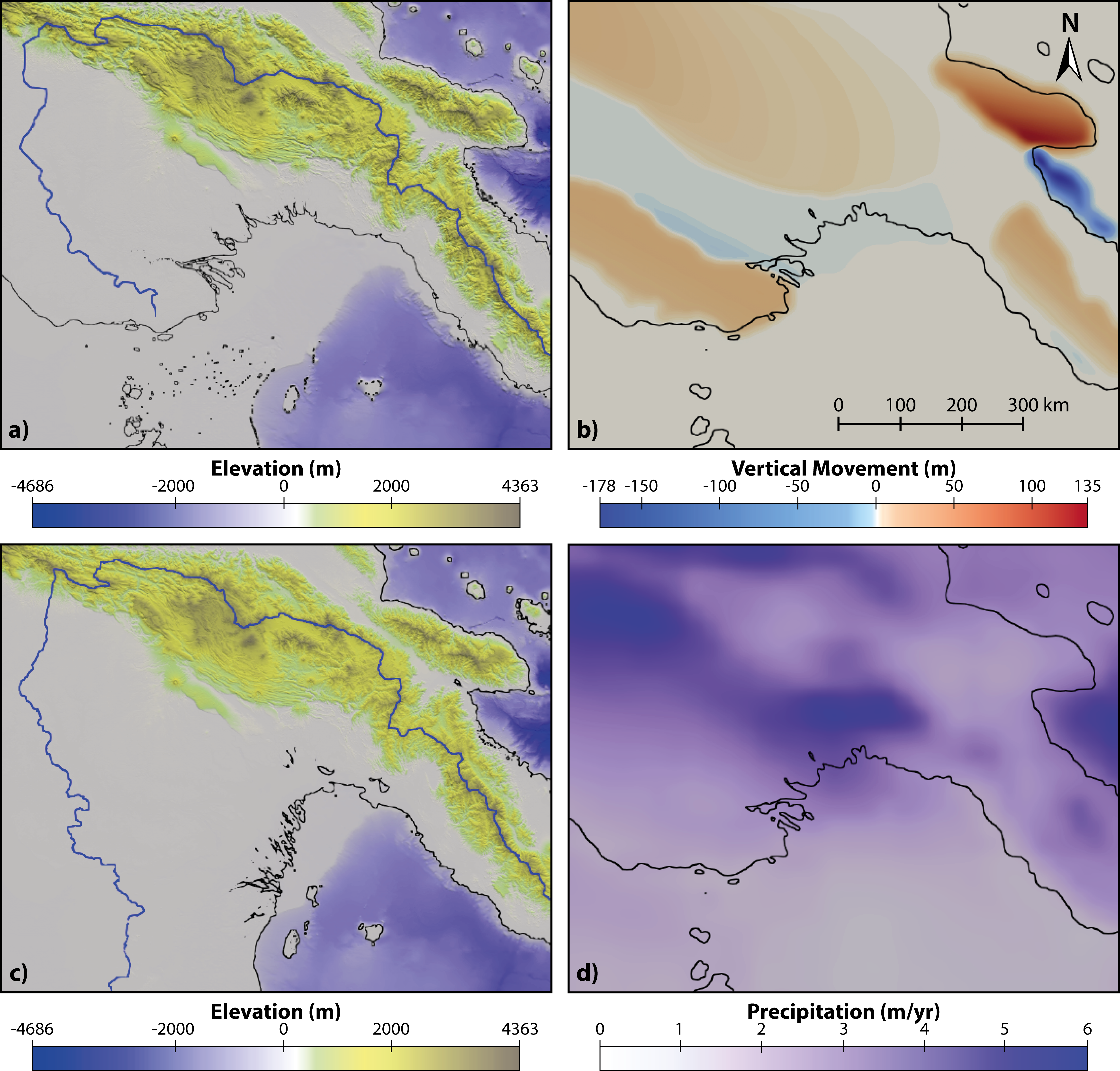 The initial setup approximates the paleotopography by subtracting the vertical movement field from the present day topography. The Lambeck et al. (2014) sea level curve is applied to the simulation for the past 35 kyr. A) The present day topography, B) the magnitude of surface uplift and subsidence over the past 35 kyr, C) the paleotopography at 35 Ka and D) present day precipitation rates.
Conditions:
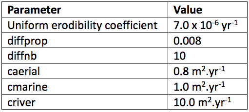 Uniform erodibility coefficient and diffprop values.
Results:
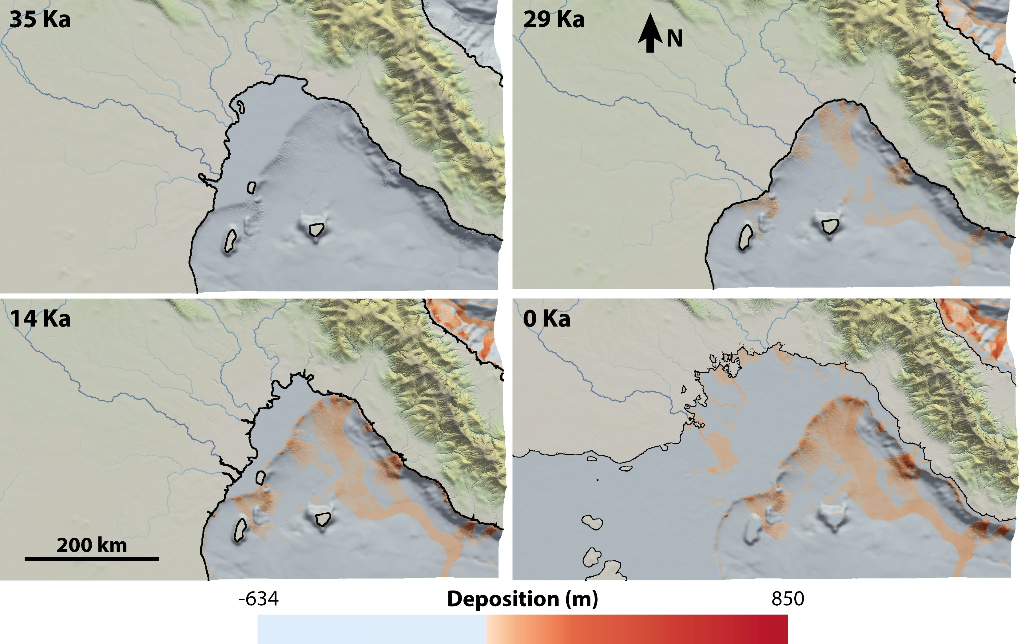 Sediment accumulation in the marine environment for A) the start of the simulation at 35 Ka, B) the end of Marine Isotope Stage 3 (MIS3), C) the end of MIS2 and D) present day.