Gippsland Basin
Xuemei(Linda) Yang, Greg Smith
Software Used:
- Badlands 1.0
Model Setup:
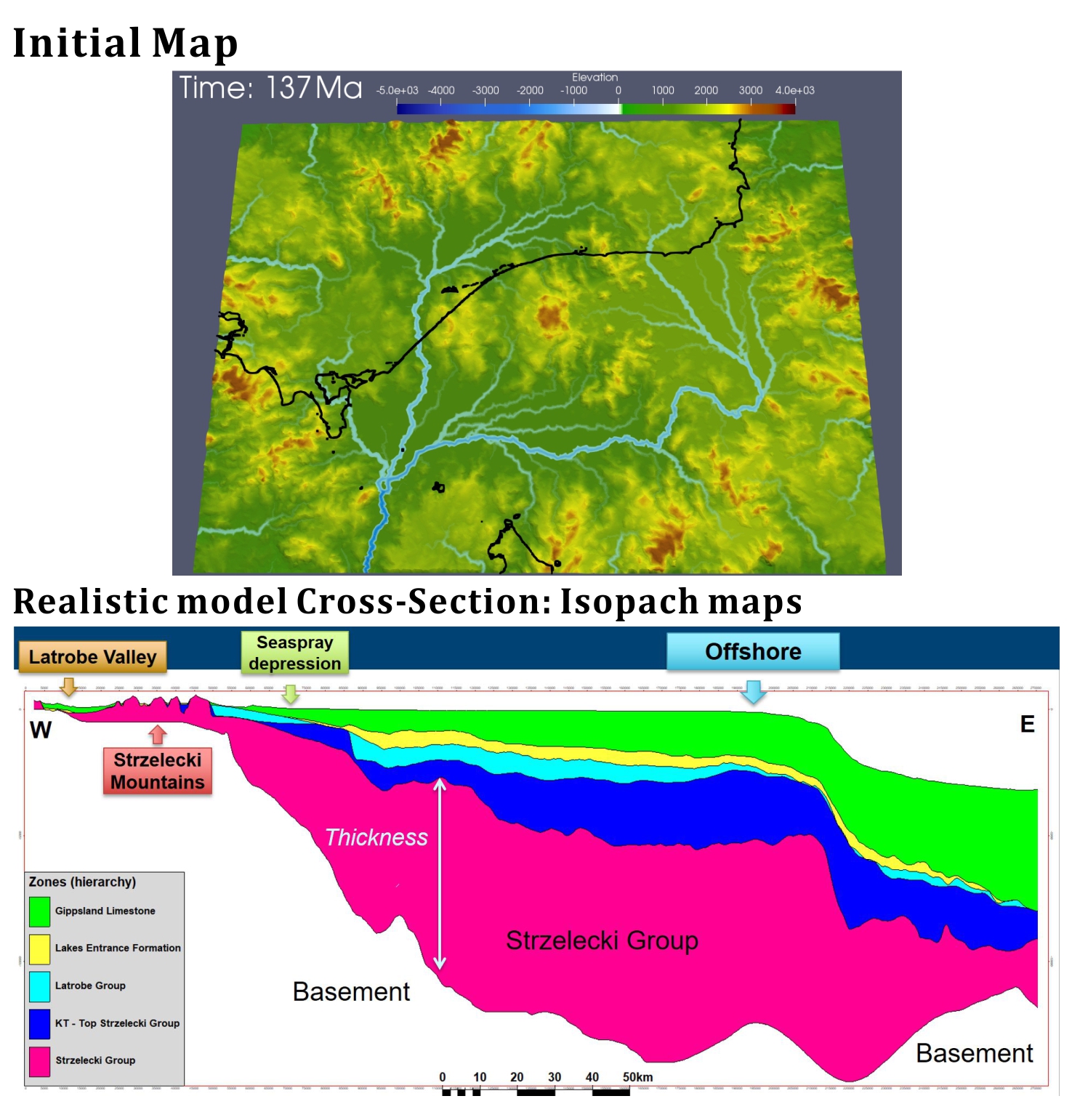 The thickness maps are input as burial displacement maps to simulate extension/subsidence history. The input maps are generated from the 3D realistic Petrel model. This model is based on seismic interpretation of all the open file 3D and 2D seismic surveys and correlation of over 250 offshore wells and more than 1000 onshore wells or bores. The interpreted seismic surfaces and well data are used to create thickness maps between the main horizons (e.g. topography, mid Miocene, top Latrobe Group, base Tertiary, top Strzelecki Group, top Basement).
Conditions:
| Uncertainties/Variables | Parameter | value |
|---|---|---|
| Non Marine Erodibility | erodibility | 2.e-7 |
| Rainfall | precipitation [m/a] | ∝ Elevation |
| (Rainfall * Area) exponent m | m | 0.5 |
| Slope exponent n | n | 1.2 |
| Slope Minimum for Flood-plain Deposition | slp_cr | 0.001 |
| Non-Marine % Max Deposition | perc_dep | 0.4 |
| Land sed. Transport by River | criver | 10 |
| Land sed. Transport by Wind | caerial | 0.001 |
| Lake/Sea sed. Transport by Currents | cmarine | 0.005 |
| No. Time Steps To Distribute Marine Deposits | diffnb | 40 |
| Marine % Max Deposition | diffprop | 5.0e-06 |
Results:
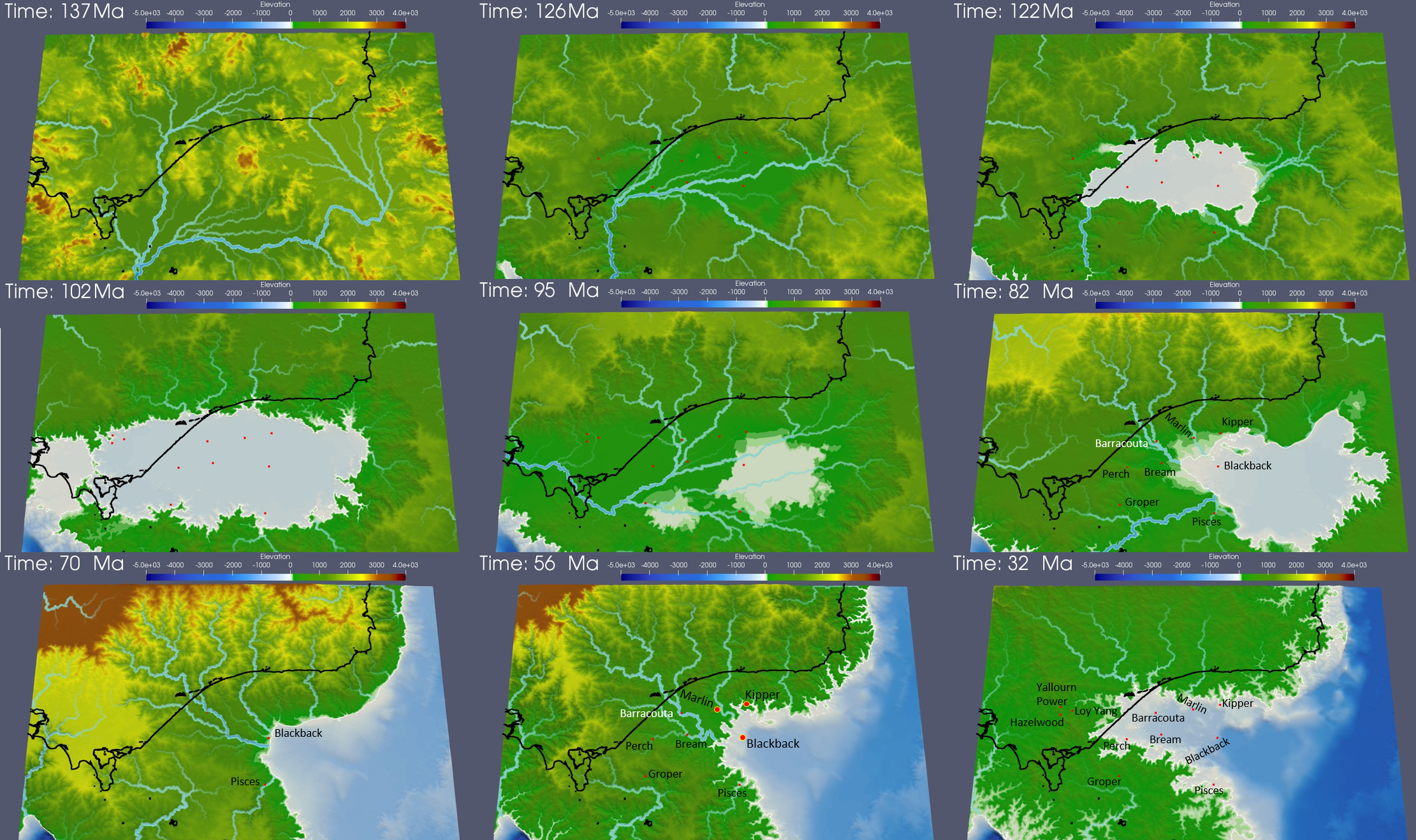 The modelling results indicate several insights for the Gippsland Basin. The initial paleo-topography at ~137 Ma comprised extensive highlands covering the entire region. The Early Cretaceous paleo-environment was intracratonic, with sediment transport from east to west, and in the late Early Cretaceous included an inland sea. The Mid Cretaceous uplift caused emergence of the entire basin, substantial regional erosion and changed the basin architecture. Subsidence associated with Tasman Sea rifting formed the Central Deep and flipped the fluvial paleo-drainage system towards the east. Latrobe Group sediments then filled the basin, the early Late Cretaceous fluvial and lacustrine sediments (including potential source rocks and good sandstone reservoirs) being progressively transgressed by marginal marine and marine sediments with rising sea levels to flood most areas by the Oligocene. Since then non-marine sediments, dominated by thick coals, were confined to the west behind a thick aggrading and prograding carbonate shelf incised by deep submarine canyons. The very rapid burial of the Latrobe Group was accompanied by slow inversion which resulted in generation, migration and entrapment of substantial hydrocarbons in large anticlines and unconformity traps.